Researcher Support Services

As our nation moves to recognizes and combat racial injustice while also recovering from COVID-19, you might be looking for ways to make a difference in both areas— and you can! Here are 5 ways to fight racial injustice and COVID-19 using geospatial resources available from our Auraria Library professionals and beyond.
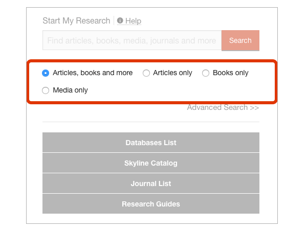
What is Geospatial Data?
“Spatial can be special,” said Diane Fritz, the Auraria Library Geospatial Services Specialist recently featured in Popular Science for her work in the field. “We’re used to thinking about data over time, but we should also think of data over space to get a complete picture.”
In other words, when we use any information in combination with location data (think about mapping) it falls into the field of research called Geospatial Science. You’ve most likely used geospatial data when you used an app to find your favorite coffee shop. The data for your coffee shop hours and services is paired with location data on a map to help you see that data in a space— it becomes geospatial data!